Introduction
Methane has long been climate change's elusive villain. Responsible for roughly 30% of global warming since the pre-industrial era and the second-largest contributor to anthropogenic climate change after carbon dioxide, methane's atmospheric concentrations are now rising at an unprecedented rate [1][2]. Yet unlike CO₂, which is emitted in vast, traceable volumes, methane escapes from dispersed sources in irregular patterns, often in remote locations that make traditional ground-based monitoring costly, slow, and incomplete [1].
That opacity has historically allowed a gap to persist between what companies report and what they actually emit. Emissions accounting has relied heavily on engineering estimates and emission factors rather than direct measurement--a system that rewards approximation and, at times, understatement. Without accurate and verifiable data, effective mitigation strategies remain out of reach [1].
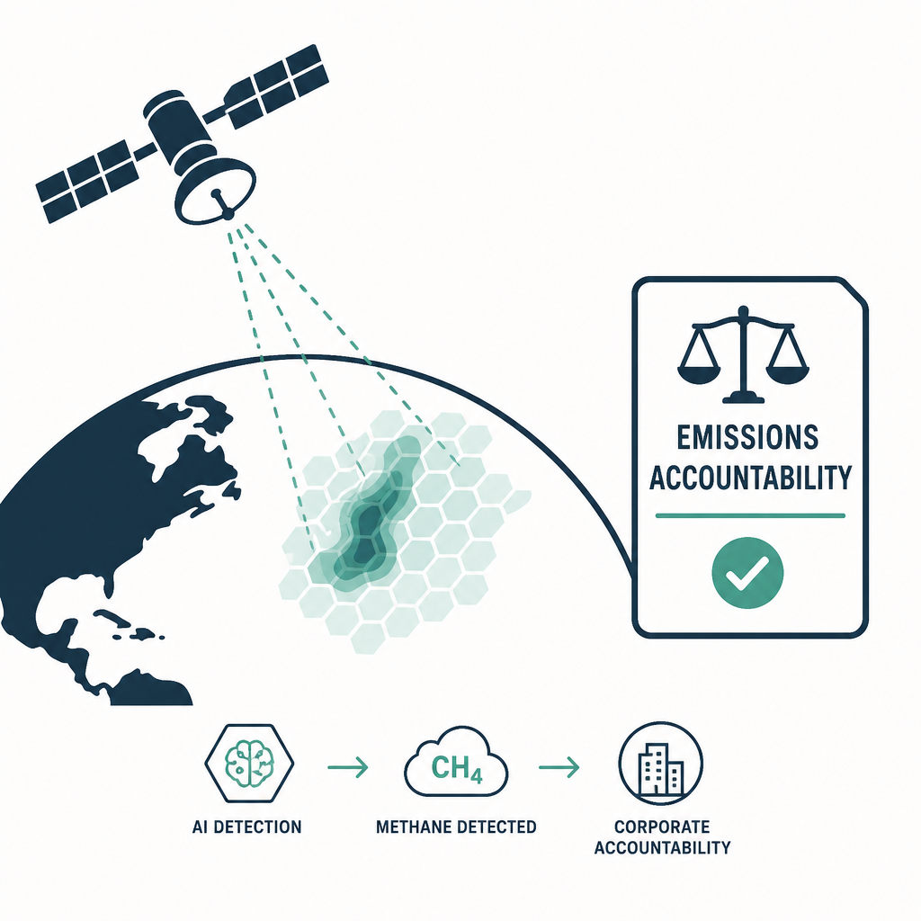
Three converging forces are now closing that gap: a new generation of satellites capable of detecting methane plumes from orbit, machine learning algorithms that turn raw spectral data into actionable intelligence, and--critically--a wave of binding regulations adopted in 2024 that formally recognize satellite observations as a legitimate verification tool. Together, they are transforming corporate methane emissions from an abstract disclosure line-item into a measurable, attributable, and legally consequential quantity. This article examines how these forces interact, what the technology can and cannot do, and what companies must do to prepare.
The Regulatory Tsunami: Why 2024 Changed Everything
From Voluntary Pledges to Mandatory Measurement
The past two years have seen an unprecedented shift from voluntary reporting frameworks to mandatory monitoring, quantification, and reduction requirements carrying significant financial penalties for non-compliance [2]. In the United States, the EPA's New Source Performance Standards (Subpart OOOOb) impose stringent methane controls on oil and gas sites constructed, modified, or reconstructed after December 6, 2022 [3]. The agency's updated Methane Emissions Reduction Program, finalized in 2024, goes further by explicitly recognizing satellite-based monitoring as a "credible measurement approach" for Subpart W facilities [4].
The most consequential innovation is the Super-Emitter Response Program (SERP) embedded in the EPA rule. It defines a super-emitter event as any quantified release of 100 kilograms of methane per hour or greater--and authorizes third parties, vetted and approved by the EPA, to monitor and notify the agency when such events occur [5]. Operators must respond within 15 days of detection [2]. In effect, any accredited organization with satellite access can now serve as an environmental watchdog with a direct line to the federal government.
Across the Atlantic, the European Union's Methane Emissions Regulation (EUMR), effective August 2024, targets methane across the entire hydrocarbon supply chain--including source-point production [3]. Importers of oil, gas, and coal into the EU must provide verified methane intensity data, and satellite observations are explicitly recognized as an acceptable verification tool under the regulation [4]. For EU-sourced hydrocarbons, operators are expected to have monitoring, measurement, reporting, and verification (MMRV) technologies integrated with their ESG procedures, with a rapid ramp-up toward quantifying emissions through direct measurement rather than estimation by February 2026 [3].
Regulation That Reaches Across Borders
The EU rules do not stop at Europe's borders. For US hydrocarbon exporters, the EUMR means heightened scrutiny of upstream methane emissions and a strong incentive to adopt advanced leak detection and quantification technologies [3]. The compliance pressure radiates through global trade more broadly: regimes such as the EU's Carbon Border Adjustment Mechanism (CBAM), US EPA standards, and the International Maritime Organization's methane strategies are all imposing monitoring expectations on high-emission logistics and industrial sectors, affecting supply chains from Asia to Europe and the Americas [6].
The Technology Stack: How AI Sees Methane From Space
A Tiered Constellation
No single satellite or retrieval method can satisfy every monitoring requirement, which is why the field has evolved into a tiered, sector-specific architecture [7]. At the regional scale, coarse-resolution instruments such as TROPOMI excel at identifying broad hotspots, while high-resolution sensors--including GHGSat, Sentinel-2, PRISMA, and EnMAP--enable facility-level measurement [7]. Bridging the two extremes, MethaneSAT maps emissions across entire oil and gas basins at 100 m × 400 m resolution, while NASA's EMIT instrument on the International Space Station has identified more than 750 methane super-emitters since 2022 [4].
At the commercial frontier, GHGSat operates a fleet of a dozen high-resolution methane-detection satellites with roughly 25-metre ground resolution [4], detecting releases as small as 100 kg/h at a 50% probability of detection, with emissions data delivered within 24 hours of observation. Its constellation observes priority sites every one to two days--catching intermittent emissions that one-time surveys inevitably miss [8]. Analytics firms such as Kayrros complement these assets with AI-powered platforms that fuse multi-source satellite data to detect methane emissions, flaring, and fossil fuel activity [4].
 Mapping global methane emissions from space with deep learning
Machine Learning Across the Pipeline
Artificial intelligence is not a bolt-on to this infrastructure--it is woven through the entire data processing workflow. GHGSat, for example, applies AI and machine learning to automatic plume detection, cloud detection, masking and filtering, and observation prioritization, ensuring data is processed efficiently and consistently before delivery [8].
The deeper transformation lies in what machine learning enables analytically. Combining ML with inverse modeling significantly improves retrieval precision, particularly for complex emission patterns, and elevates satellite observations from mere detection to dynamic source classification--facilitating predictive monitoring and mitigation planning [7]. Modern detection systems pair hyperspectral satellite imaging with ground-based sensors to identify plumes in near real time [6], while AI analytics platforms predict and quantify emissions for compliance reporting [6].
The approach is not without sector-specific challenges: spectral confusion complicates oil and gas detection, subsurface variability plagues coal mining, and spatio-temporal heterogeneity frustrates agriculture and waste-sector monitoring [7]. Algorithmic integration helps address these uncertainties, but it also underscores a central reality--credible methane intelligence requires layering satellite data with terrestrial validation and atmospheric transport modeling rather than relying on any single source [7].
From Detection to Accountability: What This Means for Corporations
The End of Estimation-Based Reporting
The most profound consequence of satellite MRV is a philosophical shift: companies are moving from estimation-based management to action rooted in verified data [1]. Under Level 4 of the MRV framework--the most rigorous tier--satellite observations are integrated with models to produce source-attributed emission estimates suitable for regulatory reporting and even carbon-market verification [4]. Commercial providers are aligning with this shift; GHGSat's facility-level data, for instance, is designed to support regulatory frameworks such as OGMP 2.0, the international measurement-based reporting standard [8][2].
For operators, the practical implications are immediate. Mandatory quarterly optical gas imaging at well sites, phased elimination of routine flaring, and super-emitter response obligations now require detection and reporting infrastructure to be deployed now, not in future planning cycles [2]. Leading operators are already using satellite monitoring as an early warning system--and, notably, as a proactive defense against activist claims [5].
A Maturing, Fast-Growing Market
The commercial ecosystem reflects this operationalization. The satellite-based methane detection market was valued at approximately USD 414.51 million in 2025 and is projected to reach USD 1.22 billion by 2032, growing at a compound annual rate of 16.68% [9]. Analysts describe a structural shift "from experimentation to operationalization," driven by improving sensor performance, data pipelines, and analytics credibility--with satellites increasingly valued as an independent source of evidence in corporate reporting and external scrutiny [9].
Crucially, the market is no longer selling imagery. It is selling end-to-end workflows: tasking, detection, quantification, attribution, triage, and repair verification [9]. Satellites provide a unifying layer of visibility across geographies and asset types, complementing on-the-ground programs when paired with targeted follow-up measurements [9]. Even small businesses are being brought into the fold, as affordable portable sensors and cloud-based reporting tools make compliance accessible beyond the majors [6].
 Development of Artificial Intelligence/Machine Learning (AI/ML) Models for Methane Emissions Forecasting in Seaweed
Governance Gaps and the Accountability Pathway
Visibility alone does not guarantee accountability. Researchers note that enough methane is already being detected to pinpoint many of the biggest leaks; what often breaks down is the step from evidence to action [10]. If satellites make methane visible, governance systems must make that visibility matter [10].
The accountability pathway is nonetheless becoming clearer and more direct: detect, attribute, repair, reduce warming pressure [10]. Satellite detection converts methane from an abstract, invisible climate problem into visible, measurable losses that companies and regulators can be held responsible for--leaks that waste valuable product, accelerate near-term warming, and often signal broader industrial pollution [10]. The regulatory penalties now attached to non-compliance give that pathway financial teeth [2], while open emissions maps and public satellite trackers allow citizens and advocacy groups to see which facilities pollute near their communities and translate evidence into pressure [10].
Closing this loop at the institutional level is the next frontier. The World Economic Forum's Centre for the Fourth Industrial Revolution is working to translate methane intelligence from emerging satellite systems into actionable policy and investment frameworks, while initiatives such as the NarSha satellite project are being developed in partnership with local governments to design region-specific monitoring frameworks--bridging what has been a significant accountability gap in the Asia-Pacific region [1].
The Road Ahead
The technical trajectory points toward still greater precision and integration. Upcoming satellite missions promise enhanced geographical resolution, reduced revisit intervals, and multi-gas detection capabilities [7]. The amalgamation of IoT sensor networks with real-time terrestrial monitoring and machine learning will enable dynamic, near-continuous pollution observation, while integrating these data streams with atmospheric inversion modeling and facility-level operational statistics will sharpen source attribution and predictive understanding of emission behavior [7].
For corporations, the message is unambiguous: the window for proactive adaptation is narrowing. Regulatory deadlines--most notably the EU's February 2026 shift to measurement-based quantification--are already converging with third-party satellite surveillance capabilities that operate regardless of whether a company has opted in [3][5]. Organizations that build credible measurement infrastructure, integrate satellite intelligence into their compliance workflows, and demonstrate rapid repair response will be positioned to meet both domestic and international standards; those that wait risk having their emissions quantified for them, by watchdogs they do not control.
 Can AI Solve the Industrial Methane Challenge?
Conclusion
The convergence of machine learning, satellite-based detection, and binding global regulation marks a genuine inflection point in corporate climate accountability. Methane--a gas once invisible to regulators, investors, and the public--can now be detected at the facility level, attributed to specific operators, and verified against legally binding reporting requirements, all within 24 hours of observation. The EU Methane Regulation, the EPA's Super-Emitter Response Program, and OGMP 2.0 have converted what was once a scientific capability into an instrument of governance, with satellites formally recognized as credible verification tools on both sides of the Atlantic.
For the oil and gas sector--the largest industrial source of methane emissions worldwide--and for the importers, traders, and logistics providers connected to it, the era of estimation-based emissions management is ending. The new operating reality is one of measurement, independent scrutiny, and rapid response. Companies that embrace this shift can turn transparency into competitive advantage; those that resist will find that from orbit, at least, there is increasingly nowhere to hide.
References
- 1.
- 2.
- 3.
- 4.
- 5.
- 6.
- 7.
- 8.
- 9.
- 10.